General note
All directions on this page, such as "right" or "left", are of course not related to the respective picture perspective, but to the main direction of flow.
If you are paddling here, please make sure you use the parking spaces and do not park at the edge of the road, even if it is full. You should carry your boat the few meters if you are paddling white water. This will save you stress with the police and will enable subsequent paddlers to continue to interact peacefully with the police and local residents.
It goes without saying that we all behave fairly towards nature, other paddlers and local residents in and on the river and should only be briefly reminded of this here...
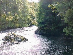
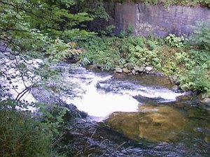
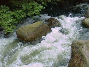
This roller, which appears unspectacular at first glance, is not very exciting unless you think you have to take a close look at it with a boat that is not really short. It holds longer boats surprisingly stubbornly (hence the common name "mousetrap"), as a rock on the right blocks the exit and the eddy on the left feeds the roller. Of course, it is still possible to leave the boat, as the lower course runs quite flat over gravel. However, the water is very cold.
A wave that was well suited to learning to surf. However, the swells on both sides were not very big and you can't paddle back up from the deeper swells.
Unfortunately, the flood at Christmas time 2023 washed away the sandpit. But there are a few mini-waves a little higher up. (Seek and ye shall find ;-) )
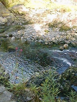
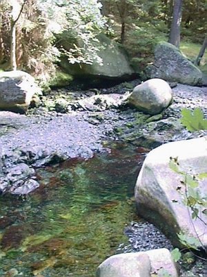
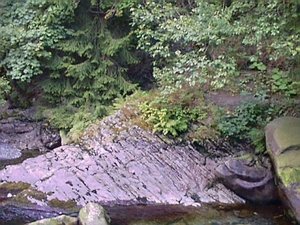
Viewed from the bank: On the right side of the river, if you look more closely, you can see a small bend halfway up. The mossy stone in the center of the picture obscures the passage. When looking "dry" from below, you can probably see the passage more clearly in the diagonal of the picture. Also nice to see: the underwater is deep and free of stones.
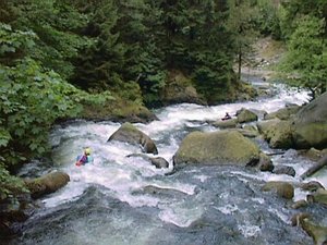
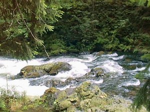
A really big hairpin bend where you can gather another group relatively shortly before entering the slalom figure of eight. Of course, only if there aren't herds of rodeo riders clogging up the spot ... . But without water, you can at least recognize a characteristic of the route here: Stones. Many, large and, above all, sharp-edged stones typical of the resin. Swimming here is a stress test for artificial or real skin.
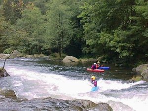
If you like, you should stop here for a moment to play.
Before the Hexenritt, there are two hairpin bends downstream (not in this picture), one on each side of the river. The Hexe is best viewed from the left bank of the river. A suitable exit point for this is, for example, the small island in the immediate vicinity of the last turning water before the Hexe on the left.
The Hexenritt seen from the road, the stones in this picture and in the following are numbered consecutively for better understanding.
The entrance to the Hexenritt is the start of an S-shaped, waterslide-like rock formation. The "Hexe" doesn't actually require much more from the paddler than hitting the entrance well and various paddle supports - but you should be able to do that. If you want more and enjoy it, you can also find a few switchbacks in this rather fast and steep section.
Without water:
The river bed is quite deep here, so swimming is generally relatively safe despite the fast current. However, it is said that there have been rather small people who have dived with all their might in order to be able to brag afterwards about having hit the only larger boulder at the bottom of the river with their head... Usually, swimmers tend to collect bruises a few meters further on in the shallower part of the Hexenritt
Directly next to the rock that can be seen at the top right of the picture, or also next to/below the large boulder in the middle, for example, there are switchbacks in which you can definitely take a break - provided you are inside first. The angular rock at the bottom left may already be an enemy of the coccyx... a witch's step, so to speak.
The fork to the right - with plenty of water for short boats
To the right of the Engagement Island, part of the Oker flows through the Topogasse, which, however, can only be enjoyed when there is an above-average amount of water and - as the name suggests - only with short boats.
To the left - the ghost train
Anyone paddling here is as good as in the ghost train (!). After the initial stage, there is another relatively large eddy on the left. An emergency brake at this point is easy to do in order to jump out of the boat and paddle in the shallow water to Engagement Island.
Otherwise, the most difficult part of the Oker continues directly.
Which is too light for ghosts thanks to the current forestry situation.
River description
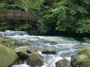
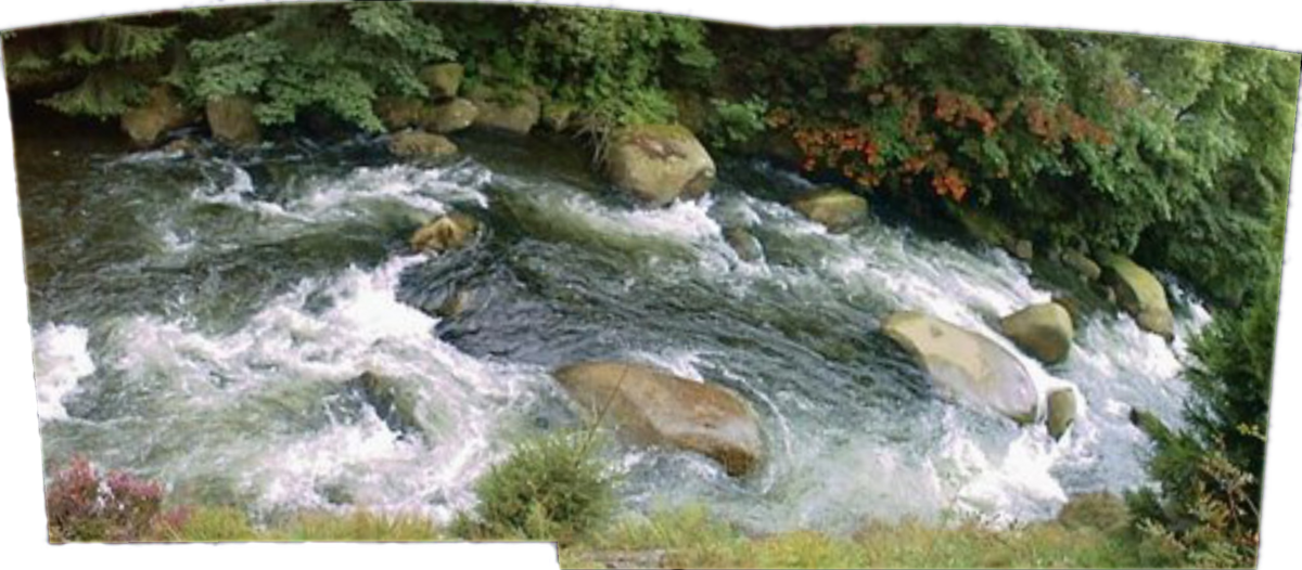
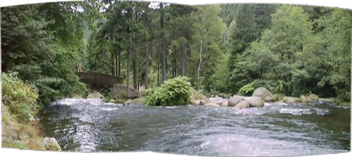
Ghost train (1) Entrance & bridge to "Engagement Island"
"Großer Tumpen": fork on the left - entrance to the "ghost train"
If you paddle here, you're as good as in the ghost train. After the initial stage, there is another relatively large bend on the left. An emergency brake at this point is easy to do in order to jump out of the boat and paddle in the shallow water to Engagement Island.
Ghost train (2) Overview
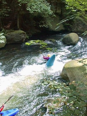
There is a different route for every taste here: rush straight through with the main current and support yourself deeply in the sharp right-hand bend, drift backwards onto the right-hand baffle water and from there hop from eddy to eddy or the "touchdown" roll with table top grabbing and scratchstone tattoo.
You can see that swimming usually makes you ouch.
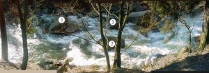
Ghost train (3) Entrance
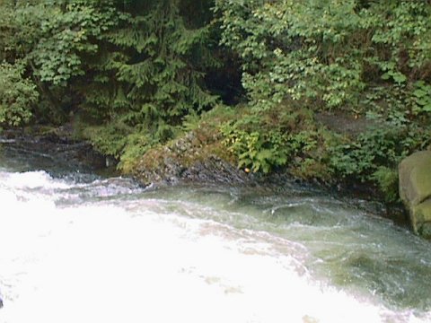
Partly in the shade is the only large eddy.
Ghost train (4) Steep bend
In this rather sharp bend, the water likes to throw you "upright", which is best answered with a determined paddle support or rolling in view of the "table top" that soon follows.
Also not nice to swim...
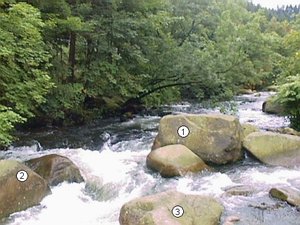
Ghost train (5) Table top
The relatively sharp-edged table top lies exactly in the main current that divides it and is probably the rock that causes the most injuries when swimming in the ghost train. Just before it, you can see a roller that holds on tightly, but can also be used to escape into the small eddy on the right-hand side of the river. From there, you can paddle safely past the table top on the right-hand side; admittedly with the risk of going for a swim in the roller beforehand and then sitting down at the table...
Ghost train (6) End and exit
There is nothing really difficult after the table top; however, the ghost train is about 100 meters longer earlier in the day, as the lower reservoir is not yet so full. The only difficulty worth mentioning in this part - which has already been flooded here - is an inclined step about 1.5 meters high, which costs more boat floor than fun.
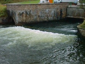
This picture was taken in the morning, the lower reservoir is still quite empty. The further course of the ghost train is roughly recognizable.
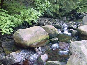
Topo lane (2) upper half
At this normal water level, you could probably get this far without any major problems...
Topo lane (3) lower half
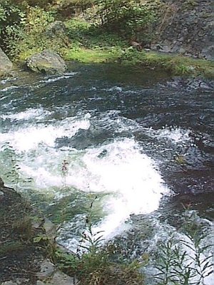
...but here it gets narrower than is comfortable. With above-average water levels, you'll be floating above things.
At the bottom of the picture, the narrowest part bares its teeth. More wild than water.
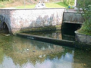
Exit
At this point, the Oker flows into the equalizing basin, which is usually still very empty in the morning and fills up by midday. The whitewater section shown in the last two pictures is therefore only suitable for early risers who arrive at the bottom before around 10 am.